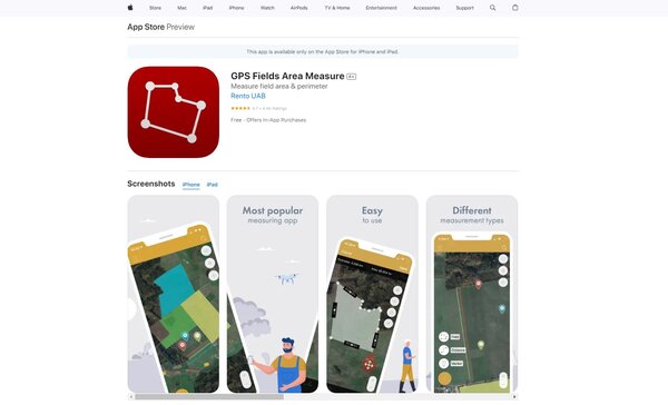
GPS Fields Area Measure
GPS Fields Area Measure is an application designed to provide precise measurements of geographical areas and distances using GPS technology. It is tailored for individuals and professionals who require accurate land measurement and mapping capabilities. The app offers a user-friendly interface, allowing for the easy mapping of fields, plotting of points, and calculation of areas or perimeters. It serves a variety of sectors, including agriculture, construction, landscaping, and real estate, facilitating tasks that involve land surveying and planning.
GPS Fields Area Measure Facts
Starting Price: Free
Pricing Model: Per Month
Free Trial: Yes
Free Plan: Available
Languages: English, Spanish, French, German, Italian, Portuguese, Russian, Chinese, Japanese, Korean
Established: 2015
What is GPS Fields Area Measure?
GPS Fields Area Measure is a versatile tool that simplifies the process of measuring land areas and distances with precision. It is particularly beneficial for professionals in agriculture, real estate, and construction who need to assess plots of land for various projects. The app’s key features include the ability to mark waypoints, draw shapes to determine area and perimeter, and save measurements for future reference. With its straightforward interface, users can quickly map out a field or a plot of land, making it an essential tool for anyone needing to perform regular land measurements and assessments.
How Does GPS Fields Area Measure Work?
GPS Fields Area Measure operates by utilizing the GPS functionality of a user’s device to accurately pinpoint and record the location of physical waypoints on the ground. As the user moves around the perimeter of an area or between points of interest, the app tracks the path and calculates the distance covered. The app can also measure areas by allowing the user to plot points on a map, which it then connects to form a shape whose area is computed. The results can be saved and exported, providing a convenient way to store and share measurement data.
GPS Fields Area Measure Features
User-Friendly Interface
The application boasts a user-friendly interface that simplifies the process of mapping out fields, plotting points, and calculating areas or perimeters, making it accessible for both professionals and individuals with no prior experience in land measurement.
Accurate GPS Technology
Utilizing the latest GPS technology, GPS Fields Area Measure provides precise measurements of geographical areas and distances, ensuring that users receive reliable data for their land surveying and planning needs.
Versatile Measurement Tools
This app includes versatile tools for marking waypoints, drawing shapes to determine area and perimeter, and saving measurements, catering to a wide range of sectors such as agriculture, construction, and real estate.
Multi-Language Support
With support for multiple languages including English, Spanish, French, German, and more, GPS Fields Area Measure caters to a global audience, ensuring that users can navigate and utilize the app in their preferred language.
Export and Share Capability
Measurements and maps created within the app can be easily exported and shared, providing a convenient solution for users to store their data or collaborate with colleagues and stakeholders on land measurement projects.
Free Plan Availability
GPS Fields Area Measure offers a free plan, allowing users to access core functionalities without any initial investment, making it an accessible tool for individuals and professionals alike who require accurate land measurement solutions.
GPS Fields Area Measure Pricing Plan
GPS Fields Area Measure offers a variety of pricing plans to accommodate the needs of different users. The app is free to download with in-app purchases available for those who require advanced features.
Free Plan: Users can download the app and access basic features without any cost. This plan is suitable for individuals or professionals who need to perform simple area and distance measurements.
Premium Subscription: For users who require more advanced features such as cloud synchronization, the removal of ads, and the ability to add photos to measurements, GPS Fields Area Measure offers a premium subscription. The subscription is available on a monthly, 6-month, or annual basis, with prices charged to the user’s iTunes or Google Play account. The cost of renewal for the subscription is identified within the app, and users can manage their subscriptions in their account settings.
GPS Fields Area Measure accepts credit cards and PayPal for payment.
Who Should Use GPS Fields Area Measure?
GPS Fields Area Measure is an invaluable tool for a wide range of users. Farmers and agricultural managers can use it for farm management, measuring fields for planting, and managing resources. Agronomists, town planners, and construction surveyors will find it useful for planning and record-keeping. Landscape artists and those involved in land-based surveys can benefit from its precise measurements for designing and mapping out areas. Additionally, it’s a practical tool for sports track measurement, construction site management, and anyone involved in outdoor activities like hiking, biking, or running who needs to measure distances or areas.
GPS Fields Area Measure FAQs
How do I start using GPS Fields Area Measure for the first time?
To begin using GPS Fields Area Measure, download the app from your respective app store and open it. The app will guide you through a brief tutorial on how to map out fields, plot points, and calculate areas or perimeters. It’s designed to be intuitive, but taking some time to familiarize yourself with all the features and settings will enhance your experience and accuracy in measurements.
Can GPS Fields Area Measure be used offline?
Yes, GPS Fields Area Measure can be used offline for mapping and measuring purposes. However, certain features, such as cloud synchronization or accessing maps that haven’t been downloaded for offline use, will require an internet connection. It’s advisable to prepare your app for offline use while you have a connection, especially if you plan to work in remote areas.
Is GPS Fields Area Measure accurate for large land measurements?
GPS Fields Area Measure utilizes advanced GPS technology to provide precise measurements, making it suitable for both small and large land areas. The accuracy can depend on the GPS quality of your device and environmental factors. For large areas, it’s recommended to ensure your device has a clear view of the sky and to check the app’s settings for any adjustments that can improve accuracy.
How can I share my measurements with others?
Measurements and maps created within GPS Fields Area Measure can be easily exported and shared through various means. The app allows you to save your data in common file formats that can be sent via email, messaging apps, or cloud storage services. This feature is particularly useful for collaboration with colleagues or stakeholders in land measurement projects.
What should I do if I encounter issues with the app?
If you experience any problems with GPS Fields Area Measure, the first step is to check the app’s FAQ section or help guide for troubleshooting tips. If the issue persists, contacting the support team through the app’s contact form or email address provided in the app store listing is recommended. They can offer more personalized assistance and solutions.
Can I use GPS Fields Area Measure for professional land surveying?
While GPS Fields Area Measure provides accurate measurements and is a valuable tool for various professionals, it’s important to note that it may not replace the need for certified land surveying services in certain legal or highly precise contexts. It’s an excellent tool for preliminary assessments, planning, and management tasks.
How does the free plan differ from the premium subscription?
The free plan of GPS Fields Area Measure offers basic features sufficient for simple area and distance measurements. The premium subscription unlocks advanced features such as cloud synchronization, ad removal, and the ability to add photos to measurements, catering to users who require more from the app for their projects.
Are there any tutorials available to learn more about using GPS Fields Area Measure?
Yes, GPS Fields Area Measure provides tutorials and guides within the app to help users get the most out of its features. These resources are designed to assist both beginners and experienced users in navigating the app’s interface and functionalities, ensuring efficient and effective land measurement and mapping.
Conclusion
Based on the comprehensive overview provided, GPS Fields Area Measure stands out as a versatile and user-friendly app designed to meet the needs of a wide range of users, from professionals in agriculture, real estate, and construction to individuals involved in outdoor activities. Its key features, including accurate GPS technology, versatile measurement tools, and the ability to export and share data, make it a valuable tool for anyone requiring precise land measurements. With options for both free and premium usage, it accommodates various user needs and preferences, ensuring accessibility and convenience.
Visit GPS Fields Area Measure Website