10 Best Boating Navigation Apps
Boating Navigation App
Navigating the waters has never been more straightforward and efficient than with the advent of the boating navigation app. These apps have revolutionized the way sailors and boaters plan their journeys, offering real-time data, weather forecasts, and route optimization at the touch of a button. The importance of a reliable boating navigation app cannot be overstated, as it not only enhances safety by providing accurate and up-to-date navigational information but also significantly improves the overall boating experience. With features designed to cater to the needs of both amateur sailors and seasoned mariners, the boating navigation app has become an indispensable tool in the boating community. The integration of GPS technology ensures that users can pinpoint their exact location, track their progress, and navigate with confidence, making the boating navigation app a must-have for anyone looking to explore the waters.
The Need for Boating Navigation App
The ocean is a vast and sometimes unpredictable entity, with changing weather conditions, currents, and tides that can affect a boater’s journey. This unpredictability underscores the need for a boating navigation app, which provides users with the tools necessary to navigate these challenges effectively. One of the primary reasons for the increasing reliance on these apps is their ability to offer real-time weather updates and alerts, allowing boaters to make informed decisions and avoid potentially hazardous conditions. Additionally, the apps’ route planning and optimization features help users identify the most efficient paths, taking into account factors such as wind direction and speed, water depth, and obstacles like buoys and other vessels. This not only saves time and fuel but also significantly reduces the risk of accidents.
Moreover, the social and community aspects of boating navigation apps have fostered a sense of camaraderie among users. Boaters can share their routes, experiences, and tips with others, contributing to a safer and more enjoyable boating community. The apps also serve an educational purpose, offering newcomers valuable insights into maritime navigation and safety protocols. With the boating industry continuing to grow, the demand for comprehensive and user-friendly navigation solutions is higher than ever. Boating navigation apps meet this demand by providing a platform that combines safety, efficiency, and community, making them an essential tool for anyone venturing onto the water.
10 Best Boating Navigation Apps
- Argo Boating Navigation
- Savvy Navvy Boat Navigation
- iNavX
- i-Boating
- ActiveCaptain
- Navionics Boating
- KnowWake
- Snag-A-Slip
- Nebo
- Pro Charts Marine Navigation
How does Boating Navigation App work?
Boating navigation apps are designed to assist mariners in planning and navigating their voyages. These apps utilize the GPS functionality of smartphones or tablets to provide real-time location data to the user. By accessing a database of nautical charts, which are essentially the marine equivalent of road maps, these boating navigation apps display the boat’s position in relation to land, underwater hazards, buoys, and other navigational aids.
The operation of these apps often begins with the user inputting their destination or selecting a point of interest. The boating navigation app then calculates a route based on the vessel’s current location, taking into consideration factors such as depth contours, navigational channels, and marine regulations. Some apps also offer features like auto-routing, which suggests the safest and most efficient path from one dock to another, considering the boat’s specific dimensions and draft.
In addition to navigation, these apps can provide valuable information such as weather forecasts, wind speed and direction, tides, and currents. This data is crucial for mariners to make informed decisions about their route and timing. Many boating navigation apps also allow users to mark waypoints, record tracks, and share their location with friends or family.
How to choose a Boating Navigation App?
Selecting the right boating navigation app involves considering several key factors to ensure it meets your specific needs. The first aspect to consider is the coverage and quality of the charts. It’s essential to choose a boating navigation app that offers detailed and up-to-date charts for the areas you plan to navigate. Some apps provide charts that are free, while others require a subscription or in-app purchases.
Another critical feature is the app’s user interface and ease of use. The app should have a clear and intuitive layout that allows you to access information quickly and efficiently. Look for apps that offer customizable views and overlays, such as satellite imagery or bathymetric data, which can enhance your understanding of the marine environment.
The app’s ability to function offline is also an important consideration. Since cellular service can be unreliable or unavailable on the water, the app should allow you to download charts and critical navigation data for use without an internet connection.
Integration with onboard systems can greatly enhance the functionality of a boating navigation app. Some boating navigation apps can connect to your boat’s AIS (Automatic Identification System), sonar, and other NMEA (National Marine Electronics Association) compatible instruments to provide a more comprehensive navigation experience.
Lastly, consider the additional features that can aid in your boating adventures, such as route planning tools, anchor alarms, weather and tide information, and community-sourced data like marina reviews and local points of interest. The app’s ability to sync with other devices and share routes and waypoints can also be beneficial, especially if you use multiple devices or sail with a crew.
Best Boating Navigation App
1. Argo Boating Navigation
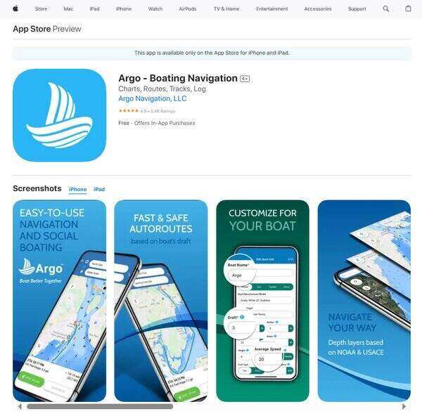
Argo Boating Navigation is a comprehensive boating navigation app designed to enhance the boating experience for enthusiasts across North America. This boating navigation app offers a blend of navigation, social interaction, and local knowledge, making it a versatile companion for anyone looking to explore waterways. With its user-friendly interface, Argo facilitates easy route planning and trip tracking, while also enabling boaters to connect with friends and the broader boating community. Its commitment to safety and exploration is evident through the provision of detailed NOAA/USACE charts and customizable routing options, catering to the needs of both novice and experienced mariners.
What does Argo Boating Navigation do?
Argo Boating Navigation serves as a multifaceted platform that significantly simplifies the process of marine navigation and social interaction among boaters. By leveraging detailed charts across North America, the app allows users to plan and navigate routes with ease, whether automatically based on the boat’s draft or manually for a more hands-on approach. It also incorporates a social dimension, enabling users to see where their friends are on the water, share their own boating experiences, and access real-time local knowledge from the community. Additionally, Argo enhances boating safety and preparedness by offering current weather conditions and forecasts, ensuring that users can make informed decisions while planning their trips.
Argo Boating Navigation Key Features
Unlimited NOAA/USACE Charts Across North America: Argo provides comprehensive and up-to-date navigational charts, ensuring boaters have access to essential mapping information for safe and informed navigation.
Auto And Manual Routing: Users can input their boat’s specifications to generate a customized, color-coded route that accounts for safety and efficiency, or opt to manually plot their course for a more personalized navigation experience.
Captain’s Log: This feature allows boaters to plan, document, and save the details of their trips, making it easier to track past voyages and plan future ones.
Current Weather Conditions: Access to real-time weather information helps users make timely decisions to ensure safety and enjoyment on the water.
Social Features: Argo’s social capabilities enable users to connect with friends and club members, share updates, and see others’ locations on the water, fostering a sense of community among boaters.
Premium Upgrade Features: For those seeking enhanced functionality, Argo offers additional features such as offline charts, extended weather forecasts, custom depth shading, and the ability to import/export GPX files, among others, through its premium upgrade.
2. Savvy Navvy Boat Navigation
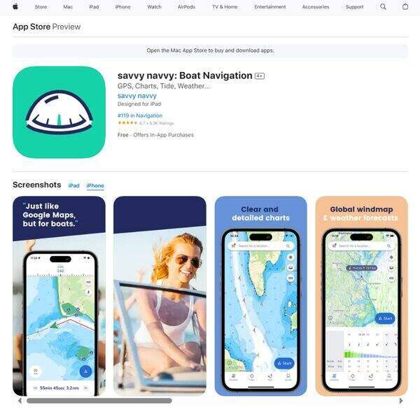
Savvy Navvy Boat Navigation is a boating navigation app designed to enhance the sailing experience for mariners of all skill levels. With a focus on delivering real-time navigation data, the app addresses the core needs of sailors by providing critical information such as current tidal movements and wind conditions. Its intuitive interface simplifies the process of route planning, making it accessible for both novice and experienced sailors. The app’s subscription model ensures that users have access to the latest features and updates, offering a service that is both reliable and up-to-date.
What does Savvy Navvy Boat Navigation do?
Savvy Navvy Boat Navigation is a boating navigation app that serves as a digital first mate for sailors, offering a suite of functionalities aimed at safe and efficient navigation. The app’s primary function is to assist with route planning by taking into account various nautical factors such as wind, weather, and tides. It allows users to input their desired destination and then calculates the optimal route, considering potential obstacles and advising on whether tacking is necessary. This level of detail provides sailors with the confidence to make informed decisions while at sea, contributing to a safer and more enjoyable sailing experience.
Savvy Navvy Boat Navigation Key Features
Real-Time Tidal Information: The app provides up-to-the-minute tidal data, which is crucial for navigating coastal waters. This feature helps sailors understand and anticipate the movement of water to avoid shallow areas and make the most of the tidal currents.
Wind Forecasts: Savvy Navvy Boat Navigation offers detailed wind forecasts that allow sailors to plan their routes according to the expected wind conditions. This can be particularly useful for sailboats, as it helps in determining the most efficient use of sails.
Route Optimization: The app’s sophisticated algorithm suggests the most efficient route to a given destination, taking into account the current conditions. This feature saves time and fuel by helping sailors avoid unnecessary detours.
Subscription-Based Updates: Users benefit from continuous updates and improvements to the app through its subscription model. This ensures that they always have access to the latest navigation technology and features.
User-Friendly Interface: Designed with the user in mind, the app boasts an interface that is easy to navigate, making the complex task of route planning more manageable for sailors of all levels of experience.
3. iNavX
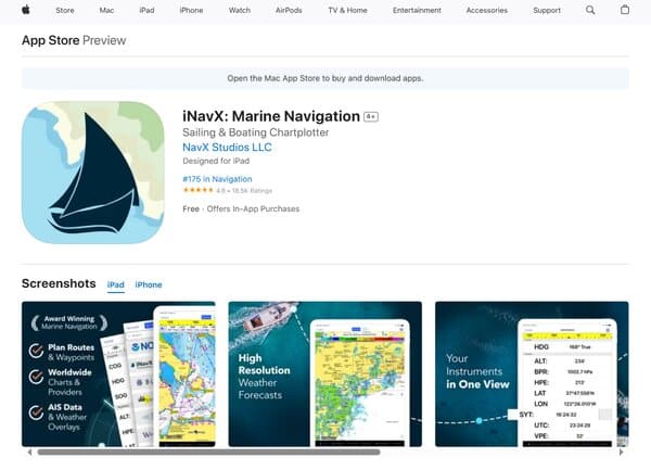
iNavX is a boating navigation app that provides sailors and boaters with a suite of navigational tools and charts on their handheld devices. As a leading Chartplotter app, iNavX offers complete worldwide chart coverage, integrating a multitude of chart providers to deliver a seamless and versatile navigation experience. With features such as one-touch access to a broad set of marine charts, including the iNavX Professional+ Chart series, and a host of navigational aids, iNavX is designed to enhance the maritime journey for enthusiasts and professionals alike.
What does iNavX do?
iNavX transforms mobile devices into a fully functional marine navigation system. It assists sailors in planning and managing sailing routes, providing proactive sail management with GRIB weather forecasts, and enhancing situational awareness with AIS overlays. For boaters, iNavX offers up-to-date forecasts and conditions, along with the ability to connect to various nautical instruments such as depth sounders, speed indicators, and wind sensors. The app also includes essential tools like tide and current information, an anchor alarm, and a comprehensive port and navaid search function. By offering a complimentary copy of NOAA RNC United States marine raster charts, iNavX ensures that users have access to official and current navigational data.
iNavX Key Features
Comprehensive Chart Coverage: iNavX boasts an extensive collection of marine charts from various providers, ensuring that users have access to the most detailed and up-to-date navigational information wherever they sail.
Advanced Route Management: The app allows sailors to meticulously plan their voyages with waypoint and route management tools, making it easier to navigate complex passages and keep track of their progress.
GRIB Weather Forecasts: With GRIB weather forecast integration, users can anticipate weather conditions, plan accordingly, and adjust their sailing strategy to ensure safety and efficiency.
AIS Integration: The Automatic Identification System (AIS) feature provides real-time vessel tracking information, enhancing safety by allowing users to see and be seen by other ships equipped with AIS transponders.
Instrument Connectivity: iNavX can connect with a variety of onboard instruments, providing real-time data on depth, speed, wind, engine performance, and battery levels, centralizing boat monitoring on one device.
Tides and Currents: Access to tidal and current data helps mariners make informed decisions about the best times to depart and the safest routes to take, considering the natural movements of the water.
Anchor Alarm: The anchor alarm is an essential safety feature that alerts users if their vessel begins to drift, offering peace of mind when at anchor.
Port and Navaid Search: A comprehensive search function allows users to quickly find ports, navaids, and other points of interest, streamlining the process of marine navigation.
4. i-Boating
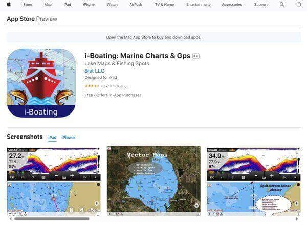
i-Boating is a comprehensive marine navigation application designed to enhance the boating experience for sailors, fishermen, and water enthusiasts alike. This boating navigation app transforms your iPhone or iPad into a detailed and user-friendly chart plotter. The app boasts a vast array of marine charts and fishing maps for regions including the US, Canada, Europe, and Australasia. With its emphasis on ease of use, i-Boating facilitates seamless navigation by providing depth contour maps, Aids to Navigation, and the integration of various marine vector charts. It stands out for its ability to operate effectively offline, making it a reliable companion for planning and executing marine routes in areas with limited connectivity.
What does i-Boating do?
i-Boating serves as a virtual first mate, assisting boaters with navigation and route planning on the water. The boating navigation app allows users to create new boating routes or import existing ones in GPX/KML format, ensuring that personal navigation data is easily accessible. It also offers voice prompt route assistance, which is a significant aid for hands-free operation while on the move. The inclusion of Tide & Currents predictions arms users with essential information to make informed decisions while at sea. Additionally, the app’s query feature enables mariners to long-press on marine objects such as buoys and lights to obtain detailed information, enhancing situational awareness and safety.
i-Boating Key Features
Hardware/GPU Accelerated Vector Charts: The app provides visually stunning and detailed vector charts that remain clear and legible regardless of zoom level or screen rotation, ensuring that text is always upright and readable.
Offline Capabilities: i-Boating is designed for offline use, allowing mariners to download maps and charts for use without an internet connection, which is crucial for areas with poor or no cellular service.
Route Assistance with Voice Prompts: This feature offers hands-free navigation, giving audible instructions to the boater, which is particularly useful when it’s necessary to keep eyes on the surroundings rather than the screen.
Import of GPX/KML Files: Users can import their own GPX or KML files into the app, making it easy to access and navigate using personal waypoints and routes accumulated over time.
Customizable Units: The app allows customization of depth and distance units to feet, fathoms, meters, kilometers, miles, or nautical miles, catering to the preferences and needs of users worldwide.
Tide & Currents Prediction: i-Boating includes predictions for tides and currents, providing valuable information for planning trips and ensuring safety while navigating in changing conditions.
Query Feature for Marine Objects: By long-pressing on any marine object on the map, users can access detailed information about buoys, lights, and obstructions, which is essential for avoiding hazards and navigating confidently.
5. ActiveCaptain
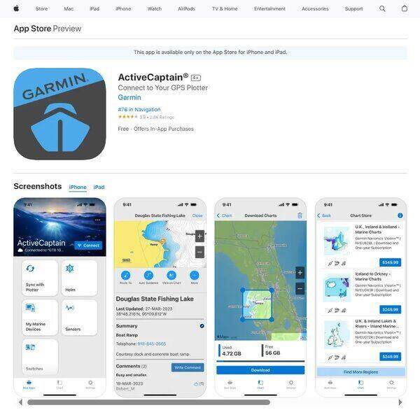
ActiveCaptain is a comprehensive boating navigation application designed to enhance the maritime experience for Garmin chartplotter owners. It serves as a dynamic link between a compatible mobile device and a Garmin chartplotter, offering a suite of features that cater to various boating activities such as cruising, fishing, sailing, and diving. The app facilitates a seamless wireless transfer of vital navigational data and integrates a community-sourced feedback system to assist boaters in making informed decisions on the water.
What does ActiveCaptain do?
ActiveCaptain is a boating navigation app that transforms the boating experience by providing users with the ability to wirelessly sync their mobile devices with their Garmin chartplotters. This integration allows for the smooth exchange of charts, maps, and software updates. Users can plan their routes, set waypoints, and receive valuable insights from the ActiveCaptain Community. For those who opt for the OnDeck hub, the app offers the capability to track and monitor their boat from almost any location, ensuring peace of mind when they are away from their vessel.
ActiveCaptain Key Features
ONECHART: This feature offers the latest in Garmin Navionics+ and premium Garmin Navionics Vision+ cartography. It boasts a Navionics style appearance and incorporates advanced Auto Guidance+ technology. Users benefit from a one-year subscription to daily updates, ensuring they have access to the most current navigational information.
Community Feedback: ActiveCaptain leverages the collective knowledge of the boating community, allowing users to access a wealth of user-generated content. This feedback can include reviews, advice, and local boating knowledge, which is invaluable for planning and undertaking journeys on the water.
Wireless Data Transfer: The app enables boaters to wirelessly update and transfer essential navigational data between their mobile device and Garmin chartplotter. This feature simplifies the process of keeping charts and maps up to date and allows for the easy sharing of routes and waypoints.
OnDeck Hub Compatibility: For those who invest in the OnDeck hub, ActiveCaptain offers the added benefit of remote boat monitoring. This feature provides users with the ability to track their boat’s location and monitor its systems, ensuring everything is secure, even when they are not onboard.
Auto Guidance+ Technology: This advanced technology assists boaters in route planning by suggesting the best paths based on the boat’s size and the desired destinations. It enhances safety and efficiency by helping to navigate around obstacles and shallow waters.
6. Navionics Boating
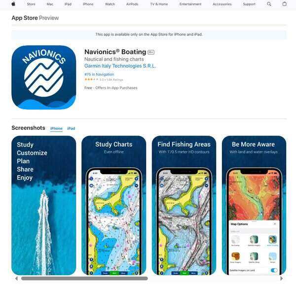
Navionics Boating is a marine navigation application designed to enhance the experience of mariners, fishermen, and water sports enthusiasts. This boating navigation app offers a suite of features that cater to the needs of users who spend time on the water, whether for professional purposes or leisure activities. With the ability to access detailed charts offline, Navionics Boating ensures that vital navigational data is always at hand, even when internet connectivity is not available. The app’s versatility makes it suitable for a wide range of water-based activities, including cruising, fishing, sailing, and diving.
What does Navionics Boating do?
Navionics Boating serves as a digital companion for anyone navigating the waters, providing a wealth of information to ensure safe and enjoyable voyages. The app delivers internationally recognized nautical charts that can be used offline, complete with multiple overlays for a comprehensive understanding of maritime environments. Users can study port plans, safety depth contours, and locate navaids and marine services with ease. For anglers, the SonarChart feature offers high-definition bathymetry maps that reveal bottom contour details, aiding in the discovery of potential fishing hotspots. Additionally, the inclusion of U.S. Government Charts (NOAA) within certain coverages adds another layer of reliability and precision to the navigation experience.
Navionics Boating Key Features
Offline Usability: One of the standout features of Navionics Boating is its ability to function without the need for an active internet connection. This ensures that mariners can access crucial chart data and navigational tools even in remote areas where connectivity is limited.
Internationally Renowned Charts: The app provides access to high-quality Navionics charts known for their accuracy and detail. These charts are a valuable resource for planning and executing maritime journeys, offering clarity and confidence to users as they navigate.
SonarChart HD Bathymetry Maps: For fishing enthusiasts, the SonarChart feature is a game-changer. It provides extremely detailed bottom contour maps that can be instrumental in locating the best fishing areas, making it an indispensable tool for anglers.
U.S. Government Charts (NOAA): The inclusion of NOAA charts for users in the U.S., Canada, Mexico, and the Caribbean ensures that the app adheres to official standards and provides authoritative navigational information, which is particularly useful for professional mariners.
7. KnowWake
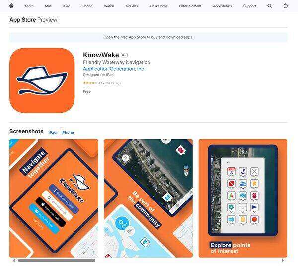
KnowWake is a boating navigation app platform that caters to boaters, offering a wealth of information on waterfront destinations across a broad geographical scope including the United States, Canada, the Caribbean, Mexico, South Africa, the United Kingdom, parts of Europe, the Arabian Peninsula, and recently expanded to cover all of Australia and New Zealand. It distinguishes itself by providing over 50,000 verified points of interest for both salt and freshwater enthusiasts. These points of interest range from restaurants and marinas to fuel docks, yacht clubs, and much more. The app leverages real-time waterway reports from its community, allowing users to see and share critical information such as hazards and marine life sightings, making it an indispensable tool for anyone looking to navigate waterways safely and efficiently.
What does KnowWake do?
KnowWake is a boating navigation app that serves as a dynamic guide for boaters and water sports enthusiasts by offering detailed, user-generated content on a wide array of waterfront and marine destinations. It simplifies the process of finding marinas, restaurants, fuel docks, and other essential services that are accessible by water. Beyond just a directory, KnowWake integrates real-time community reports into its platform, providing users with up-to-date information on water conditions, hazards, and points of interest. This feature-rich app also includes navigation aids such as wake zones, marine weather forecasts, and navigation channel markers, enhancing safety and convenience for its users. Whether planning a day trip or navigating unfamiliar waters, KnowWake equips users with the tools and information needed to make informed decisions and enjoy their time on the water.
KnowWake Key Features
Wake Zones: This feature simplifies navigation by displaying waterways in a color-coded format, making it easy for users to understand and adhere to local wake restrictions.
Marine Weather Suite: Offers current and forecasted marine conditions, allowing boaters to plan their trips according to the weather, ensuring safety and comfort.
NAVAIDS: Navigation aids such as Channel Markers, Buoys, and Beacons are included to assist in safe navigation through various waterways.
Anchor Alarm: Alerts users if their vessel moves outside of a predetermined area, adding an extra layer of security when anchoring.
Virtual Dive Flag: Increases safety for swimmers and divers by alerting other vessels of their presence in the water.
Real-Time Waterway Reports: Users can share and receive updates on hazards, marine life, police presence, and other important information, fostering a community of informed and safe boaters.
Destination Routing Based on Vessel Draft: Allows users to route directly to any of KnowWake’s points of interest on US waterways, with the distance displayed, tailored to the specific draft of the vessel.
Location Sharing: Users can share their location with other KnowWake users, either within a group or publicly, enhancing safety and social interaction on the water.
8. Snag-A-Slip
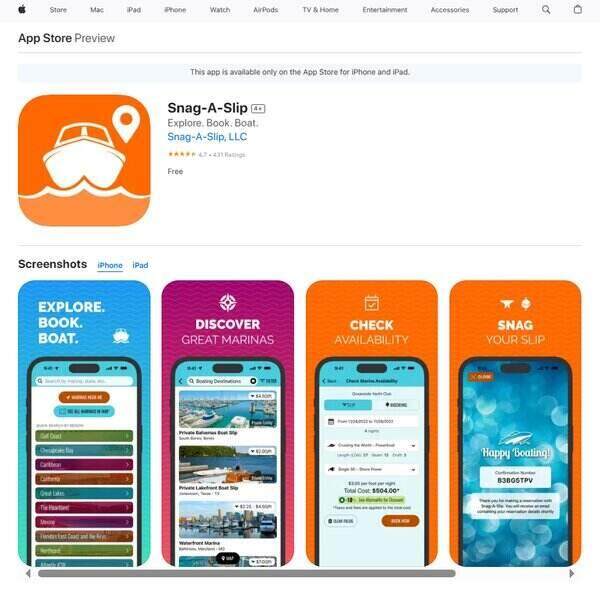
Snag-A-Slip is an intuitive mobile boating navigation app designed to simplify the process of finding and booking boat slips and moorings. Aimed at boaters looking to secure dockage, the app serves as a centralized platform that connects users with a vast network of marina partners and private slip owners. With a focus on user experience, Snag-A-Slip offers a seamless booking process, eliminating the need for multiple phone calls or navigating through various websites to find available slips. The app caters to a wide geographic range, covering areas from Canada to the Caribbean, and is tailored to accommodate a variety of vessel sizes and specifications.
What does Snag-A-Slip do?
Snag-A-Slip acts as a service for boaters to explore, book, and manage their boat slip reservations. It addresses the common pain points of marina booking by aggregating a wide selection of marinas and private slips into a single, easily navigable platform. Users can filter search results based on their specific boating needs, including location, dates, and vessel dimensions. The app also facilitates direct booking with instant confirmation, providing a hassle-free experience for boaters who are planning their trips. By offering a price match guarantee and no booking fees, Snag-A-Slip ensures that users receive competitive rates directly from marinas, fostering a transparent and cost-effective reservation process.
Snag-A-Slip Key Features
Marina and Private Slip Network: Snag-A-Slip boasts a comprehensive network of marina partners and private boat slips, offering users a wide selection of docking options across various regions. This feature allows boaters to find and compare slips that meet their specific needs, whether they are cruising locally or planning an extended voyage.
User-Friendly Interface: The app’s interface is designed for ease of use, enabling boaters to quickly navigate through the booking process. With a clear layout and intuitive controls, users can effortlessly search for slips, view marina details, and complete reservations without unnecessary complexity.
Advanced Filtering Tools: Snag-A-Slip provides advanced filtering options that allow users to refine their search based on vessel length, beam, draft, and shore power requirements. This ensures that boaters can find a slip that perfectly fits their boat’s specifications.
Immediate Booking Confirmation: The app offers immediate booking confirmation, giving boaters the peace of mind that their slip is secured. This instant confirmation feature streamlines the reservation process and helps users avoid the uncertainty of waiting for marina responses.
Saved Vessel and Contact Information: For frequent users, Snag-A-Slip allows the saving of vessel and contact information within the app. This convenience means that returning users can book future slips with just a few taps, making the checkout process faster and more efficient.
No Booking Fees and Price Match Guarantee: Snag-A-Slip stands out by not charging any booking fees, and it also offers a price match guarantee. This commitment to affordability ensures that users are getting the best possible rate for their slip reservations, aligning with the app’s customer-centric approach.
9. Nebo
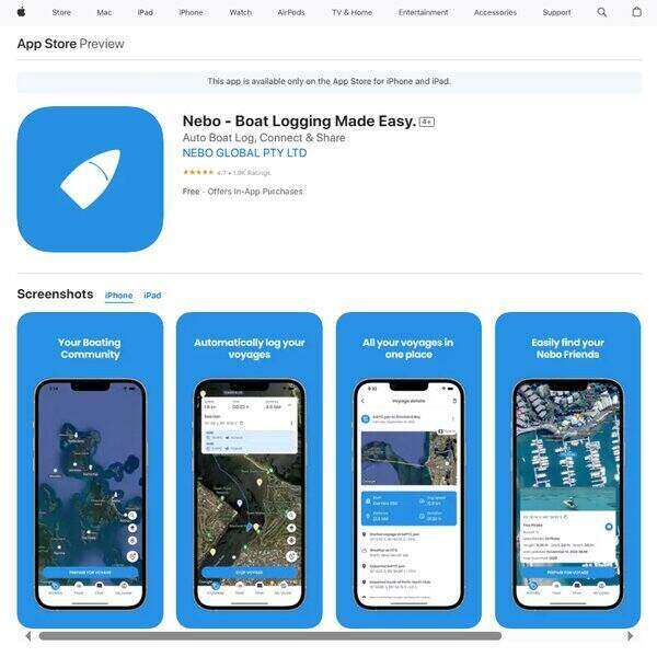
Nebo is a boating navigation app designed to enhance the boating experience by simplifying the process of logging voyages, tracking weather conditions, and connecting with the boating community. It caters to both amateur and seasoned sailors by offering a suite of tools that automate the logging of voyages, provide detailed summaries of boating activities, and facilitate communication among boaters. With its user-friendly interface and robust functionality, Nebo aims to replace traditional paper logbooks by offering a digital solution that not only records but also enriches every boating journey.
What does Nebo do?
Nebo is a multifunctional platform for boaters, offering a seamless way to log voyages, monitor weather conditions, and engage with a global boating community. By automating the task of logging, it allows sailors to focus more on the experience and less on the paperwork. The app provides detailed summaries of each voyage, including weather data, speed changes, and routes traveled. Additionally, it fosters a sense of community by enabling boaters to communicate with each other, share locations, and even assist in ensuring safety on the water. Whether you’re a solo adventurer or part of a larger group, Nebo offers tools and features designed to enhance the boating experience for everyone involved.
Nebo Key Features
Detailed Voyage Logs: Nebo automatically generates comprehensive logs of your boating activities, including routes, speed, and weather conditions, making it easier to track and share your adventures.
Community Engagement: The app allows boaters to connect with each other, share experiences, and communicate directly, fostering a sense of community among users.
Safety Features: With location sharing and the ability to message nearby boats, Nebo enhances safety on the water by ensuring that someone always has your back.
Customizable Startup Checklist: Before setting sail, users can create and go through a personalized checklist to ensure that all necessary preparations are made, enhancing safety and readiness.
Weather And Location Tracking: Real-time weather updates and location tracking are integral to Nebo, providing sailors with essential information to make informed decisions while at sea.
10. Pro Charts Marine Navigation
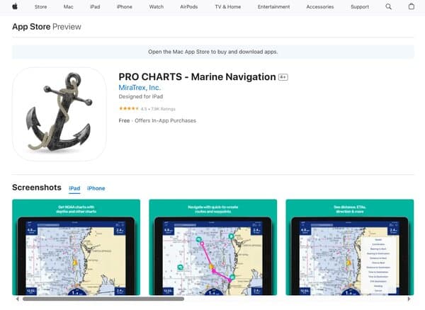
Pro Charts Marine Navigation is a robust marine navigation system that caters to a wide array of maritime enthusiasts, from casual weekend cruisers to professional offshore captains. It harnesses the capabilities of iOS devices to deliver high-resolution NOAA nautical charts for comprehensive coastal, Great Lakes, major U.S. River systems, and Brazilian waters coverage. The app prides itself on its user-friendly interface, allowing for seamless creation of waypoints and routes with a simple touch. Additionally, it ensures mariners can navigate without the need for an internet connection by allowing chart downloads in advance, making it a reliable tool for open-water navigation.
What does Pro Charts Marine Navigation do?
Pro Charts Marine Navigation is a boating navigation app designed to enhance the safety and efficiency of maritime travel. It facilitates easy route planning with its one-touch waypoint and route creation feature, whether pre-planning at home or spontaneously while at sea. The app also includes a buddy-tracking feature, enabling users to locate friends on the water, with the added option to conceal one’s location for privacy. For safety, it offers the ability to create and send a Float Plan to contacts, which can be vital in emergencies. The app’s point-and-steer navigation simplifies staying on course, while the track recording feature allows mariners to review their journey retrospectively.
Pro Charts Marine Navigation Key Features
High-Resolution NOAA Nautical Charts: Pro Charts Marine Navigation provides detailed chart coverage that is automatically updated with NOAA corrections, ensuring mariners have the most current information for navigation.
One-Touch Waypoint and Route Creation: The app simplifies the process of marking waypoints and plotting routes, making it accessible for users of all skill levels to plan their journeys with ease.
Buddy-Tracking Feature: This social feature allows users to see the location of friends on the water, fostering a sense of community and safety among boaters.
Privacy Option: Users can choose to hide their location with a simple touch, offering privacy when visiting secret spots or when solitude is desired.
Float Plan Creation and Sharing: The app enables users to easily create and disseminate Float Plans, which are essential for safety and can be forwarded to search and rescue teams if necessary.
Point-And-Steer Navigation: Navigation is made straightforward with the red heading bug on the compass, guiding users to their next route point without complication.
Offline Functionality: Pro Charts Marine Navigation is designed to function without an internet connection, allowing mariners to download necessary charts beforehand and rely on them while at sea.
Track Recording: Users can track their real-time position and view their track history, which is useful for reviewing past trips and monitoring progress.
Fully Indexed POI Database: The app includes a comprehensive database of points of interest, including weather, navigation aids, obstructions, tides, currents, and more, enriching the navigation experience with valuable data.
FAQs on Boating Navigation App
What is a Boating Navigation App?
A boating navigation app is a software application designed for use on smartphones, tablets, and other mobile devices to assist with marine navigation. These apps provide a range of features such as GPS tracking, chart plotting, route planning, and access to nautical charts that cover coastal waterways, inland lakes, and rivers. They often include additional functionalities like weather forecasts, tide and current information, and the ability to mark waypoints and record tracks. Boating navigation apps are used as primary navigation aids or as backups to traditional onboard equipment.
How do Boating Navigation Apps work?
Boating navigation apps work by utilizing the device’s built-in GPS to determine the user’s location and display it on a digital nautical chart. Users can plan routes by entering destinations, and the app will suggest the safest and most efficient course based on the boat’s specifications and current water conditions. The apps often allow for downloading of offline charts for use in areas with poor or no internet connectivity. Some apps also integrate with onboard systems through Wi-Fi or Bluetooth, providing a more comprehensive navigation solution.
Are Boating Navigation Apps reliable?
Boating navigation apps are generally reliable for navigation purposes, but their reliability can be influenced by factors such as the accuracy of the device’s GPS, the quality of the charts, and the app’s ability to update information in real-time. While they are a valuable tool for modern boaters, it is recommended to use them alongside traditional navigation methods and to have backup plans in place, as technology can sometimes fail.
Can Boating Navigation Apps replace traditional navigation equipment?
While boating navigation apps offer many features that are found on traditional navigation equipment, they are not intended to completely replace onboard systems like chartplotters, radar, and sonar. Instead, they serve as a complement to these systems, offering portability and convenience, especially for smaller vessels or when planning away from the boat. It is important for safety to maintain traditional navigation equipment, especially for long voyages or in challenging conditions.
What features should I look for in a Boating Navigation App?
When choosing a boating navigation app, look for features such as accurate and up-to-date nautical charts, route planning and tracking, offline chart access, weather forecasts, tide and current information, AIS integration, and the ability to sync with onboard equipment. User-friendly interface, good customer support, and regular updates are also important factors to consider.
Are there free Boating Navigation Apps available?
Yes, there are free boating navigation apps available for download. However, they may offer limited features compared to paid versions. Free apps might provide basic chart plotting and GPS tracking, but access to advanced features like detailed charts, weather data, and route planning may require a subscription or in-app purchases.
How do I ensure my Boating Navigation App has the latest chart information?
To ensure your boating navigation app has the latest chart information, regularly update the app and download the latest chart data. Most apps provide automatic updates when connected to the internet. It’s important to check for updates before setting out, especially if you’re planning to navigate in unfamiliar waters or where conditions change frequently.
Conclusion
Boating navigation apps have become an integral part of the modern boater’s toolkit, offering a range of features that enhance the experience and safety of navigating on water. With the ability to track location, plan routes, and access vital nautical information, these apps provide convenience and reassurance. However, it’s crucial to remember that they should be used in conjunction with traditional navigation methods and equipment. Regular updates and a clear understanding of the app’s capabilities and limitations are essential for making the most out of this technology. Whether you’re a seasoned sailor or a weekend cruiser, a boating navigation app can be a valuable asset for your maritime adventures.